Road Trip Day 2 18-2-22

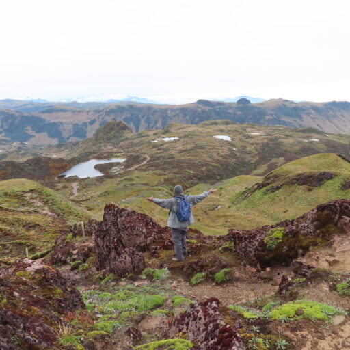
Spent the night in Ingapirca and first thing in the morning visited the Ingapirca ruins. It is a combination of the Canari peoples temple to the moon and the later Inca temple to the sun. Super cool. Lots of history of the indigenous people in this area.

Carnari temple to the moon predates the Inca Sun Temple
This is a burial tomb of they think a priestess or princess and her servants.
Looking at the moon temple from the sun temple/
The town of Ingapirca
Sun temple where the Inca king would stay when visiting.
Baths
Back side
Inca face
Local home
Stone sink (grinding stone) at a home near the temple
Local home

Chimborazo 17-2-22 Road Trip

Left Thursday morning a 4am on a little road trip. First stop was Chimborazo Forest Reserve. It stretches over 58,560 hectors or 145,000 acres. The altitude varies from 3800 meters (12,467 feet) to 6310 meters.

Chimborazo volcano is the closest point on the planet to the sun. The summit is 6310 meters high which equates 20,702 feet. The highest point in Ecuador. It was early morning and clear allowing views of the summit.

The Vicunas are a wild mammal related to Alpacas and llamas which also live in the reserve. The Vicunas were hunted to extinction in Ecuador for their meat. They were reintroduced with animals from Chili, Peru, and Argentina. Today they are protected.

On the trail walking up to the base can you can see in the distance Tungurahua volcano. It is peaking out above the clouds smoking away. Located in the Amazon it is very far away.

It was a beautiful day!

The trip continued as we headed to the Indigenous ruins at Ingapirca………….

The first view of Chimborazo as you go through a town.
Getting closer to Chimborazo volcano.
Elevation at base camp is 5000 meters (16,404 feet)
Elevation in the parking lot 4800 meters (15,748 feet)
Tungurahua volcano in the Amazon a long way away smoking.
Zoomed in on Tungurahau volcano poking out above the clouds.
Vicunas

“CASA KIREI”

Good day everyone. As many of you know my dearest friends in Ecuador have opened a small Bed and Breakfast in Tumbaco just 45 minutes form the capital of Ecuador Quito.

For all of my family and friends I suggest starting your trip here if you would like to explore Ecuador. I promise you will have no regrets. With great enthusiasm I give two thumbs up, Randy

Que significa “Kirei”.

Kirei es un adjetivo del idioma japones que significa hermosa, bello, bonito.

What does “Kirei” mean?

Kirei is an adjective from the Japanese language that means beautiful. A word that describes the essence of “Casa Kirei”.

Inca Road (Quapaq-nan)2-8-22

After being stopped by the mud while heading to the Volcano I turned the driving over to Daniela as she had never driven in a 4×4 situation. It was good experience and after we got to town we switched seats and hit the highway. I asked what was plan B and Daniela said home. My thoughts were like no way it’s to early to head back to the city there has to be somewhere to go.

While driving down the highway i remembered a road I had taken by myself when I returned from exploring a Pucara back in December. Daniela had never been on it and she mentioned we could cut across and end up in La Quiche using the Inca road. We had started on that section of road before but turned around and I can’t remember why. So off we went.

After leaving the highway we switched seats again. The trip up to the first set of pucara’s was an easy drive and we only took one wrong turn that dead ended in a farm yard, Once we started on the Inca road it was a little different. The rain had made it a muddy mess in quite a few places so it was back to 4×4. That section I thought was just a short hop over a small pass but turned out to be much longer. I am glad we went this way for I really enjoyed it. Lucky for us that we went the direction we did for we would not have made it going the opposite direction. This made up for not making it up Cayambe volcano (a little bit).

The old Inca road which traverses up and down the Andes.
Enjoying the rain
An Andean hawk was walking along the road feeding on the worms that were trying to get out of the water.
Beautiful
Inca road (Qhapaq-nan) at over 13,000ft (4000m)
Pucara in the foreground then El Tabon and Las Puntas in the distance.

Failed attempt to get to Cayambe Volcano 2-8-22

So last time we visited the Cayambe-Coca National Park we did not get there until later in the day and did not have time to make it all the way to the base camp at over 14,000ft. On Tuesday we left at 4am and headed to the park. Well we arrived at the registration gate at 6:30 and guess what? The gate does not open until 8am, oops. We took a little siesta until opening time. As before the gate keeper told us the road was horrible and 4 wheel drive only but did say we could make it to the camp. If I remember correctly it is 16km or approximately 10 miles and around 45 minutes time wise. We made it about half way and were turned around by the mud. Just couldn’t make it up a long steady grade without losing traction as there was a light mist in the air keeping everything wet. I was super disappointed for I was looking forward to a good hike. I will have to wait until after the rainy season I suppose. Bummer

This is a shot from the bottom of where we had to turn around. Doesn’t look like much in the pictures but farther up it was just a sloppy, slick mess.
Daniela was making fun of my sulking